

Page, Arizona - Landmarks of the Southwest
September 2003
In September 2003 I went on another workshop with Steve Kossack. This time to the Page, Arizona area. If you get the idea that I enjoy Steve's workshops then you are right. It takes me about 6 hours to drive to Page. Since driving to the airport and flying to Phoenix takes about the same length of time, I just drove. (Not to mention the 5 hour drive from Phoenix to Page.) I got there a bit before sunset and before the group arrived. I tried to find a spot to shoot sunset, but guessed wrong and ended up without any good images that night. That's the advantage of going with Steve. He puts you in the right spot at the right time. The trip was fantastic. I got more good images on this trip than any of my previous ones. We had a great group that got along well. I'll post links to their images of the trip as they become available. This was also my first big trip with the Canon EOS 1Ds. It performed flawlessly. It was also my first trip without film. I carried the Canon EOS 10D as a backup camera. It never made it out of the bag.
Canon EOS 1Ds, Canon 100-400mm f/4.5-5.6 IS L, ISO 100
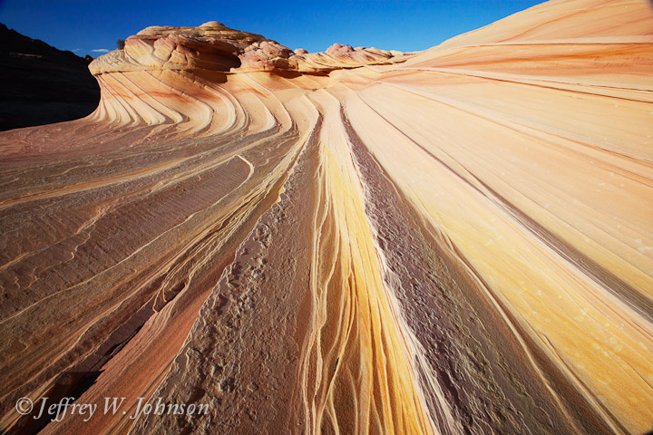
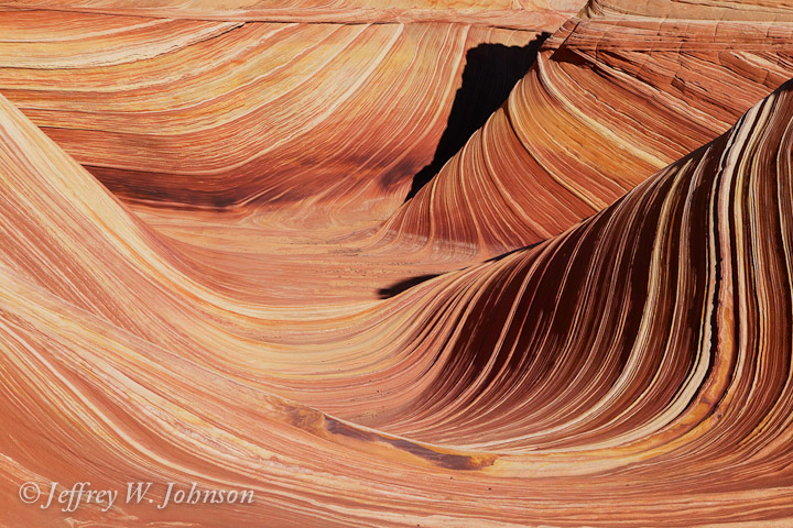
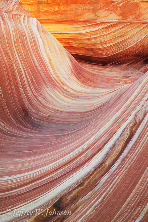
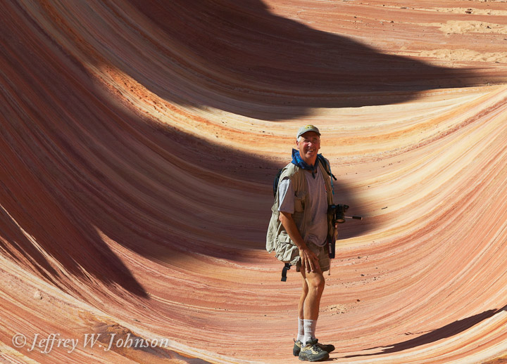
Second Wave - The Swirl
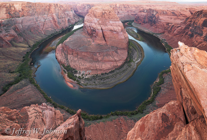
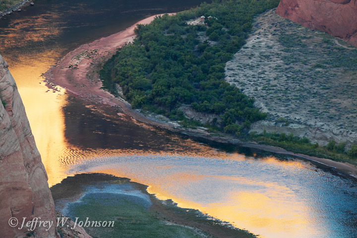
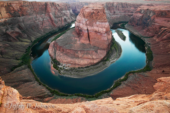
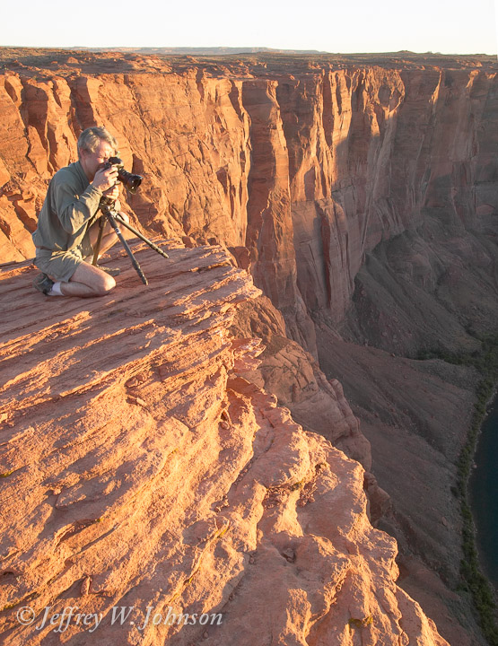
Horseshoe Bend is just a couple of miles outside of Page. We shot our first sunrise there, and also shot sunset the second day. It was interesting to see the difference. On the second time out, several of us got a little crazy with edge of the cliff. I had two of my tripod legs about an inch from the edge with the tripod leaning toward the canyon. It makes me queasy just to remember it. I don't know what I was thinking at the time. Probably one of those "guy" things. Once the sun comes up or before it goes down it's hard to get a good picture because of the extreme contrast between the sunlit background and the canyon below. Here are my attempts.
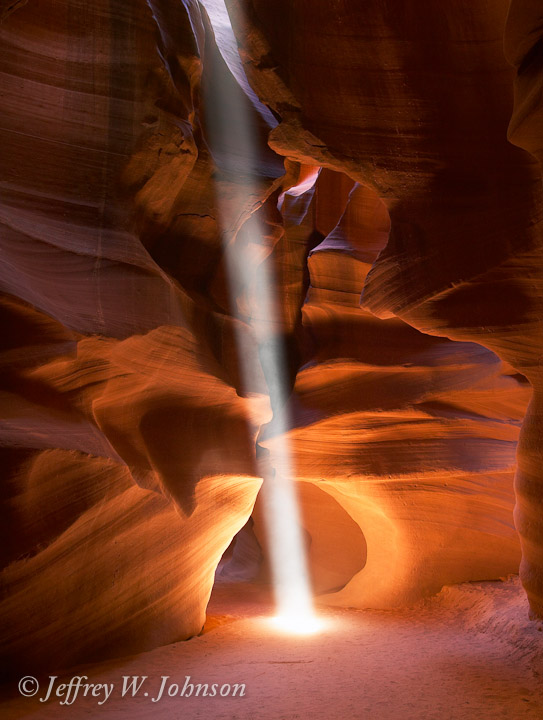
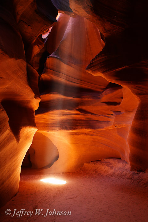
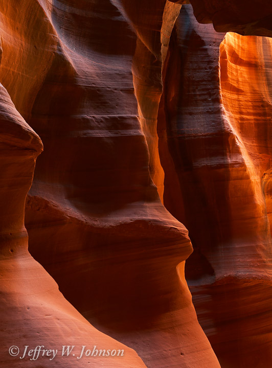
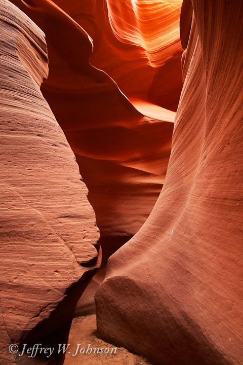
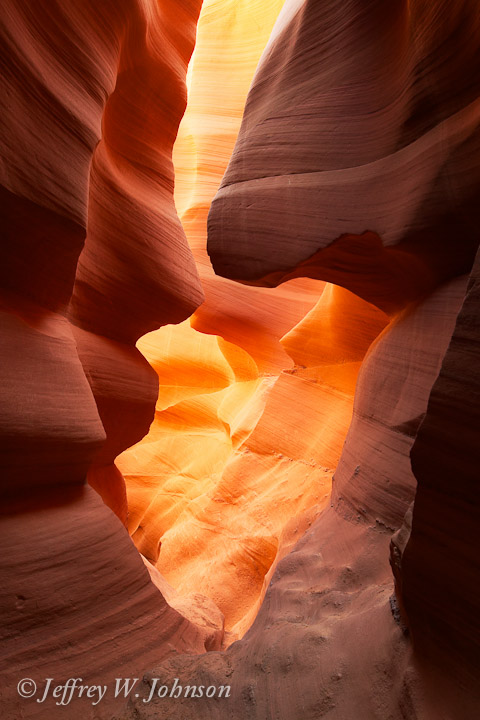
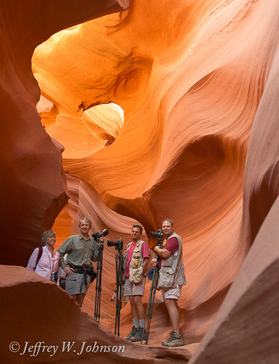
This was my second trip to Upper Antelope Canyon. For images of my May 2002 trip check here. Upper Antelope is pretty crowded most of the time. Most people are good about waiting for you to finish shooting, but occasionally someone is using a camera with the flash on which wrecks havoc with 30 second exposures. The canyon is only about 1/4 mile long, but I think you could spend days in there and still not notice everything. You can move away from a spot and come back 30 minutes later and it looks entirely different due to the changing light.
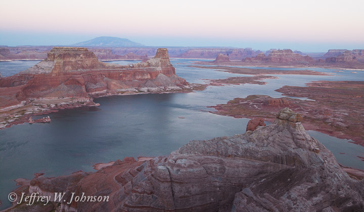
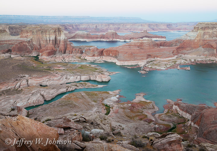
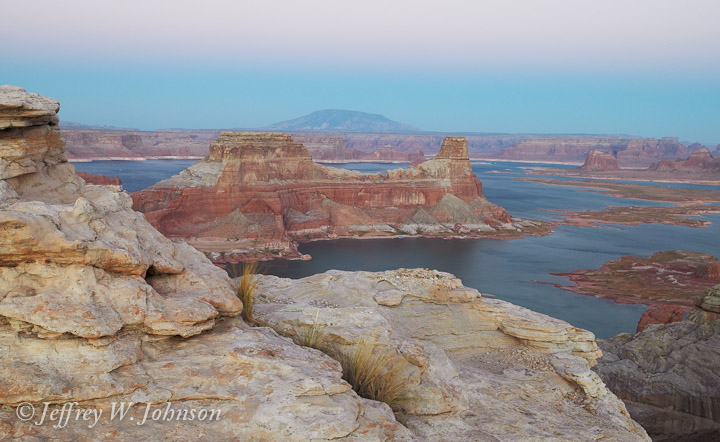
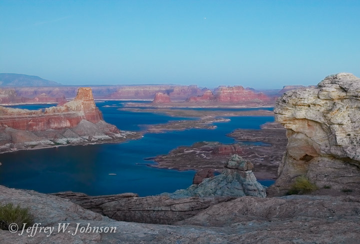
I'm sure you've all heard the expression "40 miles of bad road". I think this is where they got the expression. (It's either here, or the road to the Racetrack in Death Valley.) Actually the first two thirds of the trip are on some pretty high quality graded roads. You start out by driving through terrain that looks suitable for training astronauts for the first Mars mission. Then you gradually work your way around the north edge of Lake Powell until you come out on a point overlooking Padre Bay and Gunsight Butte. We arrived just a few minutes before the sun disappeared. I thought my best pictures were taken after sunset.
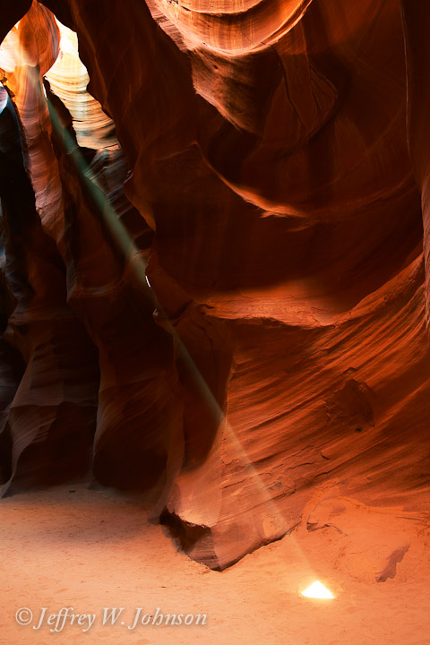
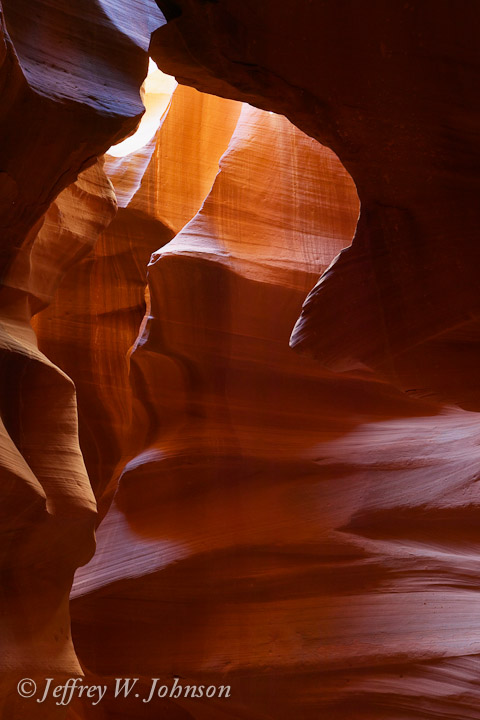
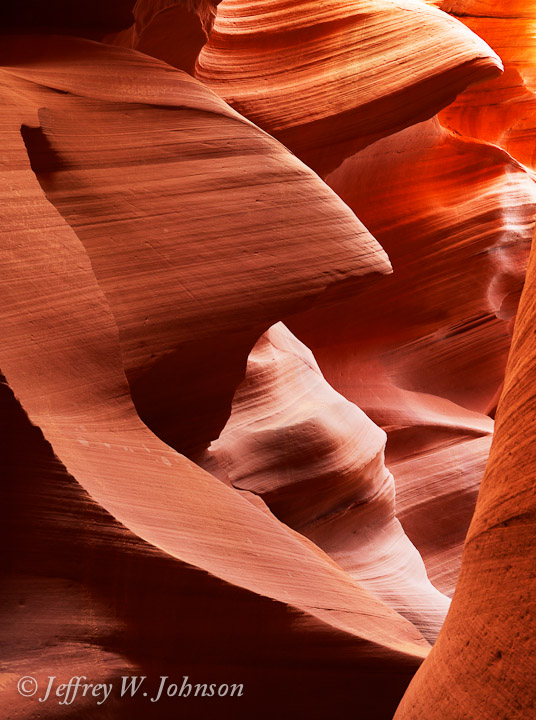
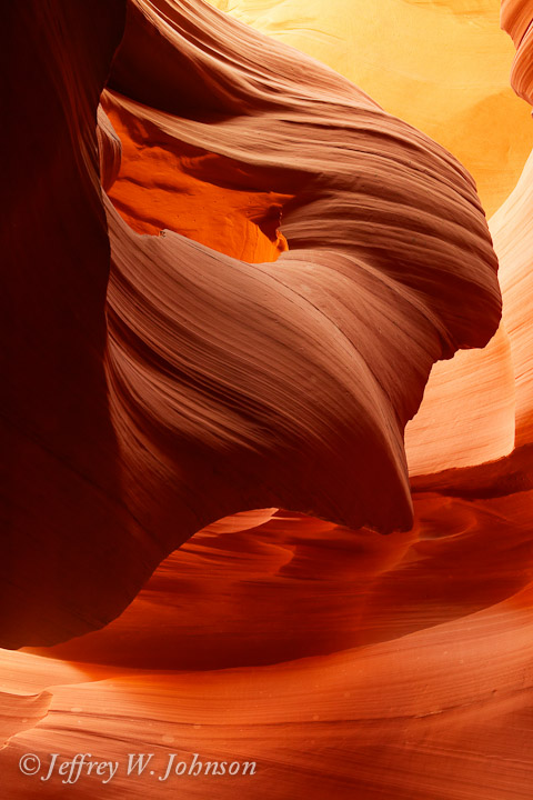
This was my third time in Lower Antelope Canyon. For images of my May 2002 trip check here. Lower Antelope is much more open at the top, but in many places narrower at the bottom. It lets more light in, so is better earlier in the morning. A series of very well engineered ladders and steps helps you up and down the canyon. There are usually fewer people in Lower Antelope.
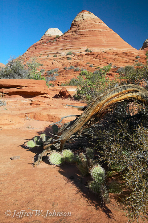
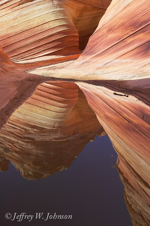
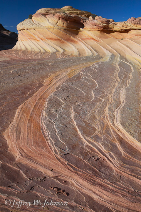
In order to spend as much time as possible at the Wave, we timed it so we left the vehicles at the trailhead when it was just light enough to see the trail. We saw a lot of interesting things on the way to the Wave and nearby. If you do this hike, bring lots of water and plan on being out in the sun for a long time. The trail is about 3 miles each way.
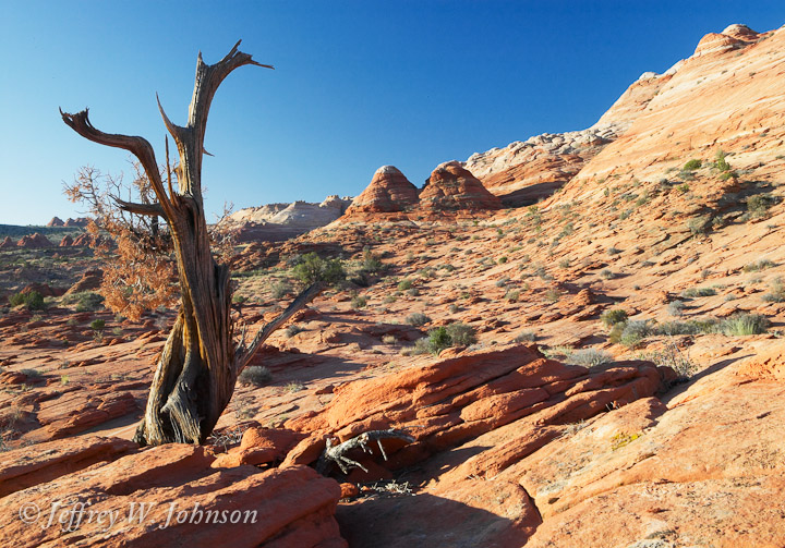
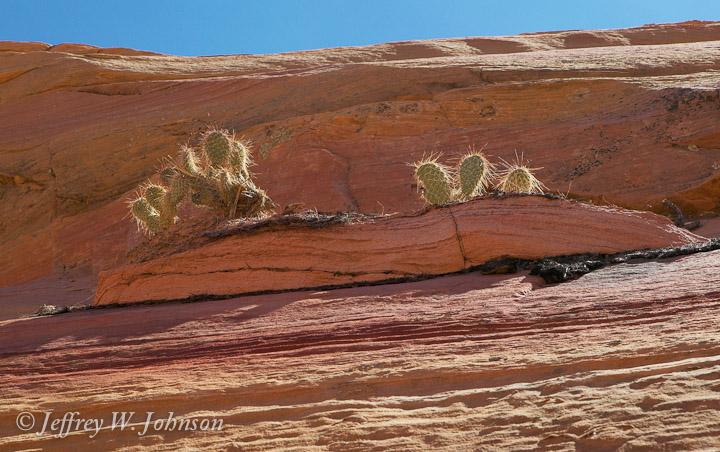
I've been hearing about and reading about the Wave for several years. My problem was getting a permit to make the hike. They only allow 14 people a day in to this area to keep it from getting ruined. Ten permits are given out on the internet 6-7 months ahead of time and the remaining four are given out on a drawing basis the day before they are valid. One of the big attractions of this trip for me was the opportunity to hike to the Wave.

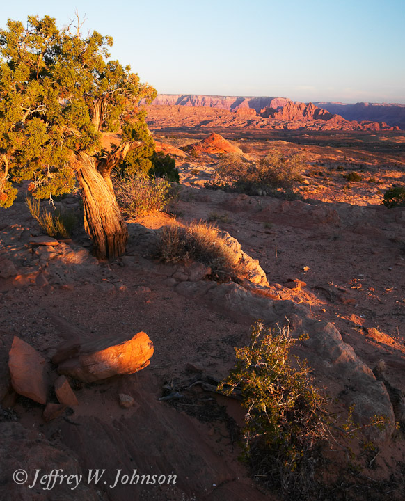
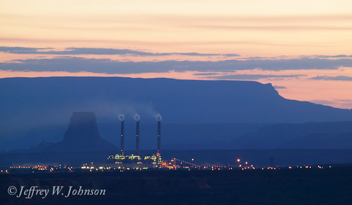
The last morning of the trip, as everyone else was getting ready to drive to Phoenix and catch planes, I headed out to Little Cut to catch the sunrise. It's an area about 10 miles out of Page heading south. There are interesting rock formations as well as a nice view back towards Page and Navajo Mountain.
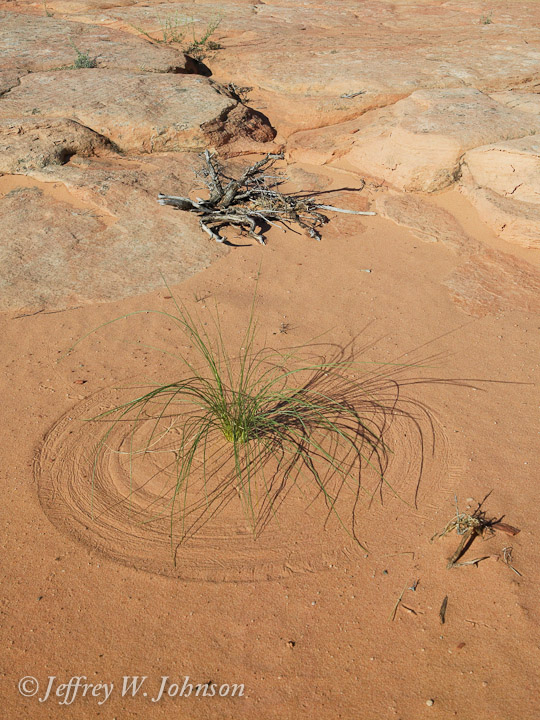
This is a collection of interesting images that don't seem to fit in other areas.
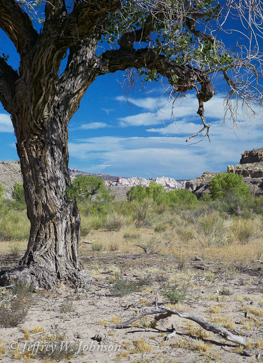
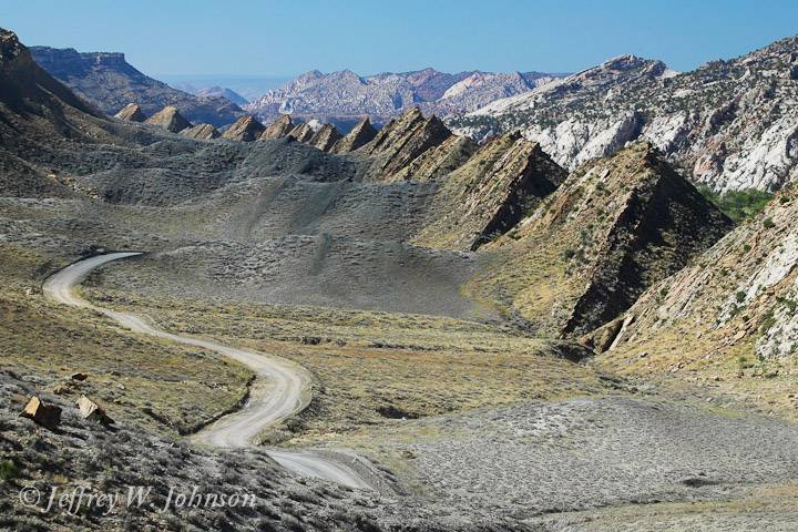
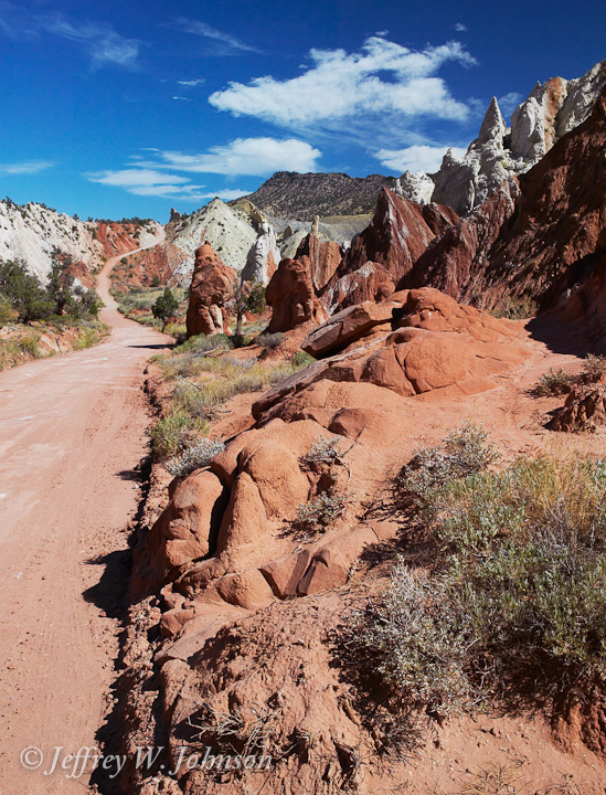
Instead of driving back the same old way up highway 89, I decided to take the Cottonwood Canyon road. It leaves highway 89 about 20 miles from Page and heads almost straight north and comes out just east of Bryce Canyon National Park. I stopped along the way for some interesting shots. I did drive into Bryce and took a nap there for a couple of hours, but the mid-day light "the harsh light of reality" wasn't helping make any good images.
For all my images of this trip including ones not in this gallery check my Image Catalog under Page, Arizona 03.